
The website of the Library of Identification Resources has a new feature: a map view. The resources in the catalog are associated with a geographic scope to approximate which species in a taxonomic group can be identified. These geographic scopes are usually countries or continents but can also be subdivisions within countries, multinational ecological regions like mountain ranges, and biogeographical realms.
The scopes are also linked to Wikidata identifiers, and the Wikidata identifiers are linked to iNaturalist identifiers. This makes it possible to get GeoJSON of these places from the iNaturalist API. Then the places can be displayed with the Leaflet library, and shaded according to the number of resources associated with it.
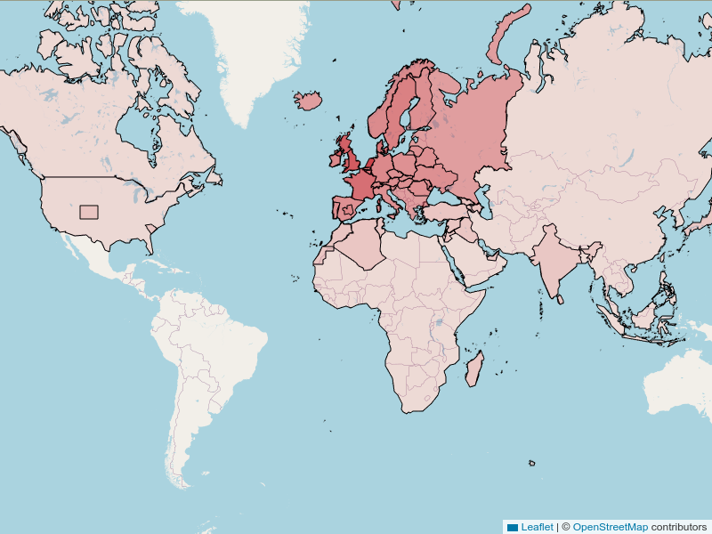
World map with countries, continents and other regions shaded according to the number of associated resources.
There are a number of places that are not displayed:
- The biogeographical realms are not all in iNaturalist (e.g. Indomalayan realm).
- Some places like have ambiguous definitions (e.g. the Middle East) making it difficult to decide whether to link their Wikidata & iNaturalist entities if different definitions are used.
- Other places are historical and are difficult to express in modern borders (e.g. Japanese Empire in ca. 1930).
- A number of resources have scopes that have never been expressed in political borders (e.g. “the coast of Italy”).
All in all 347 of the current 1286 resources are not displayed, though it should be noted that 72 of those have no scope (e.g. keys for all globally known species).
Either way, the map clearly shows the geographical bias: Western Europe, especially the Netherlands, is overrepresented. This is because I have been mostly adding Dutch resources and various series from the UK (RES Handbooks), France (Faune de France), Denmark (Danmarks Fauna), Sweden (online keys and Nationalnyckeln), and Norway (Norske Insekttabeller).
The map is available from the home page and at https://identification-resources.github.io/catalog/visualizations/map.


No comments:
Post a Comment